Something deep under Antarctica is changing, and the effect is almost poetic: a subtle dent in Earth's gravity field has been gradually deepening for tens of millions of years. You won't feel it underfoot. You won't see it from a plane. But when geophysicists map the planet's gravity—the geoid—this region stands out as one of the most persistent depressions, and new research suggests it's becoming stronger as slow-moving mantle processes reshape the planet from within.
Reading Earth's hidden shapes
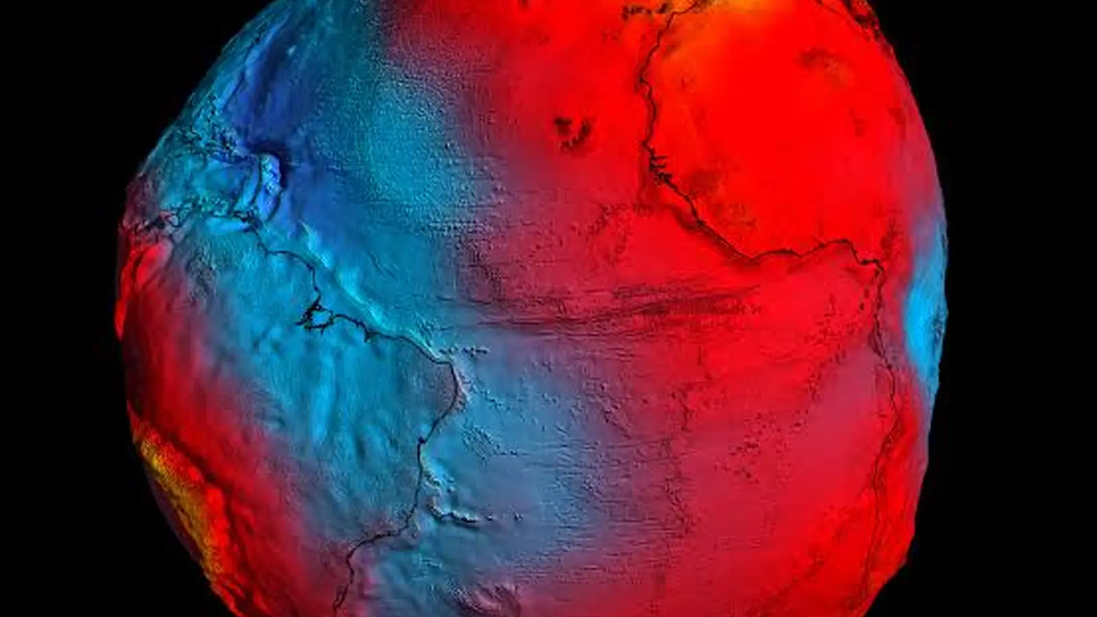
The geoid is an abstract surface: imagine the global mean sea level stretched out across continents. It traces gravity rather than topography, so it reflects mass anomalies beneath the crust—regions where denser or lighter rocks tug a little harder or softer on objects at the surface. The differences are tiny in everyday terms (a bathroom scale might shift by a few grams), but to geoscientists they are a powerful diagnostic of what the mantle and deep lithosphere are doing.
Alessandro Forte of the University of Florida and Petar Glišović of the Paris Institute of Earth Physics approached the problem with a pair of complementary tools. First, they used seismic tomography—the way earthquake waves speed up or slow down as they pass through different materials—to build a three-dimensional density model of Earth's mantle beneath Antarctica. Think of it as a CT scan of the planet, where earthquakes provide the illuminating rays. Then they folded that density model into physics-based simulations of mantle flow and gravity to reconstruct the geoid through deep time.
The results match contemporary satellite gravimetry remarkably well. That agreement gives the researchers confidence that their model captures the essential anatomy of the Antarctic geoid low. From that starting point they performed a geodynamic rewind: running the mantle flow model backward to examine how the gravity depression has evolved since the early Cenozoic, roughly 70 million years ago, and then forward again to test whether the model returns to the present-day geoid.

How a gravity low forms and why it matters
The picture that emerges is one of gradual transformation. A gravitational depression near Antarctica has existed for at least 70 million years, but its shape and intensity changed markedly about 50 million years ago. According to the simulations, carpet-like slabs of oceanic lithosphere had been subducting and sinking into the mantle beneath and around Antarctica. These dense, sinking slabs altered mass distribution in the deep mantle and produced a persistent geoid low at the surface.
At the same time, a broad swath of hot, buoyant mantle material rose beneath the region, slowly asserting its influence over the past 40 million years and strengthening the geoid low. The model also reproduces records of True Polar Wander—the slow reorientation of Earth's rotation axis relative to the solid Earth—adding another check on its plausibility. By aligning with both satellite gravity and paleorotational history, the study links convection in the mantle to surface observables in a coherent way.
Why should anyone care about a hairline gravity dip under Antarctic ice? Because the geoid controls the shape of the sea surface. Where the geoid sits lower, the ocean surface tends to sit lower too. That raises an intriguing possibility: a falling geoid near Antarctica could have locally lowered sea level, changing coastal and grounding-line conditions at a crucial time in Earth's climate history. The timing aligns with major steps in Antarctic glaciation—ice sheets began to expand in earnest around 34 million years ago—so while causation is far from proven, the link is plausible and worth testing.
This research demonstrates that the slow choreography of mantle slabs and buoyant upwellings can leave fingerprints on sea level and ice-sheet behavior, even if the effects are subtle and unfold over tens of millions of years.
Implications, tools, and future directions
The study underscores the value of integrating seismic imaging, satellite gravimetry, and physics-based mantle modeling. Satellite missions such as GRACE and its successors have revolutionized our ability to map Earth's gravity field. Seismic networks provide the complementary interior view. Combined, they let scientists test whether deep Earth processes inferred from seismic velocity anomalies also predict the gravity signal and historical polar motion recorded in rocks and sediments.
For glaciologists and sea-level researchers, the takeaway is twofold. First, mantle-driven geoid changes are a non-negligible component of long-term regional sea-level history and must be considered alongside climate-driven factors such as ice melt and thermal expansion. Second, because mantle flow operates on millions-of-years timescales, its influence is most relevant to geological and deep-time climate studies—but it can also inform models of ice-sheet stability by altering baseline boundary conditions.
Future work will need to tighten timelines and mechanisms. Can high-resolution mantle models and improved seismic datasets pinpoint when and where the geoid shifted most rapidly? Can sedimentary and paleoshoreline records around Antarctica corroborate predicted local sea-level drops? These are testable questions. The machinery exists; it's a matter of refining inputs and integrating disparate datasets.
Expert Insight
“What I find most compelling,” says Dr. Lina Moreno, a geodynamics specialist unaffiliated with the study, “is the causal chain the authors propose: slab subduction, mantle rearrangement, geoid modification, and then possible impacts on local sea levels and ice-sheet behavior. Each link has uncertainty, but the methodology ties observations and theory in a convincing way. It reminds us that the solid Earth is a slow but active partner in Earth's climate system.”
Small in appearance, large in implication: the Antarctic gravity hole is a reminder that Earth's interior moves, and its motions ripple outward through oceans and ice. There are many questions left to answer—but the deeper you look, the more the planet's interior begins to explain the surface stories we've been trying to read.

“The cosmos has always fascinated me. I write about space missions, astronomy, and the technologies pushing humanity beyond Earth.”

Discussion
Leave a Comment