The World Meteorological Organization now puts the odds at roughly four in five that El Nino will form between June and August, a shift that could feed stronger heatwaves, heavier rains, and deeper droughts around the globe.
Why the alarm bell is ringing
Warm water is gathering in the tropical Pacific. That simple physical change ripples outward, altering winds, pressure patterns, and where rain falls. Historically, El Nino events have appeared every two to seven years and persist for about nine to 12 months. Right now the WMO says the pattern is moving from neutral toward El Nino, with probabilities near 80 percent for June through August and approaching or exceeding 90 percent by November.
Forecast models increasingly suggest this event will be at least moderate in strength and could be strong. Subsurface temperatures in the central-eastern equatorial Pacific have been running unusually high, in some analyses more than 6 degrees Celsius above the long-term average. The atmospheric counterpart, tracked by the Southern Oscillation Index, is lining up too. Those indicators combined have convinced forecasters that the phenomenon is likely to develop and influence global weather into next year.
How El Nino changes the weather equation
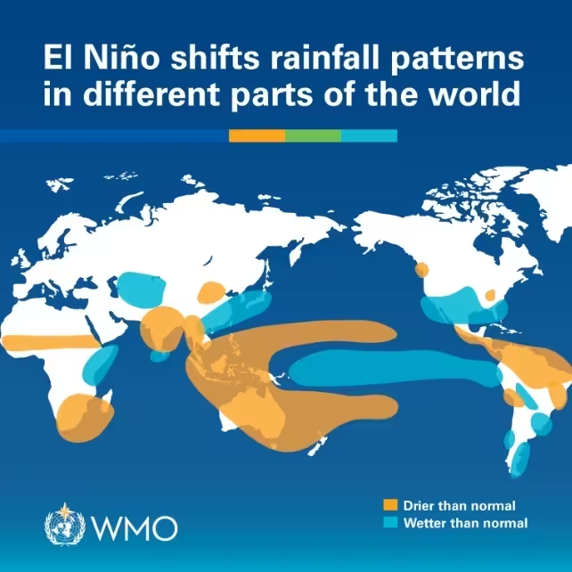
Think of El Nino as a giant, shifting weather engine. When the tropical Pacific warms, it pumps extra energy and moisture into the atmosphere. That raises the odds of heat extremes on land and in the ocean, and it can steer storms and monsoons into different patterns than normal.

Some effects are regional but widespread: reduced rainfall in parts of the northern Greater Horn of Africa during the crucial June to September rainy season; below-average monsoon rains across South Asia; and drier, warmer summers in parts of Central America. Meanwhile, oceanic warming tied to El Nino tends to favor hurricane activity in the central and eastern Pacific while suppressing it in the Atlantic basin during the northern hemisphere summer.
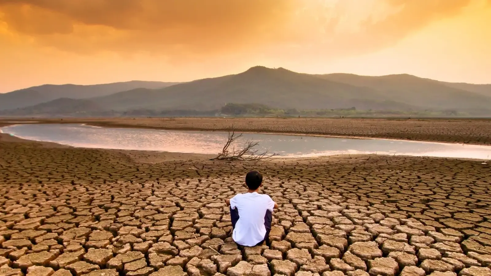
The WMO cautions that even a moderate El Nino raises the likelihood of extremes rather than guaranteeing them. Still, the combination of a predicted El Nino and a world that has already warmed by recent decades makes the stakes higher than in past decades. The last El Nino-related influence helped push 2023 to be the second-hottest year on record and contributed to 2024 reaching an all-time high, roughly 1.55 degrees Celsius above the 1850-1900 pre-industrial baseline.
Voices from the UN and weather science
WMO chief Celeste Saulo summed up the practical concern: the world needs to prepare for an El Nino that could "exacerbate drought and heavy rainfall and increase the risk of heatwaves both on land and in the ocean." Early action matters. Forecasts that show a near-global dominance of above-normal temperatures for June to August increase the risk of compounding hazards, such as heat plus drought or intense rains that follow long dry spells.

United Nations Secretary-General Antonio Guterres framed the moment as both an immediate warning and a political call to action. "El Nino is arriving on our doorstep," he said, urging accelerated climate action: ending fossil fuel dependence, expanding renewables, protecting vulnerable communities, and ensuring early warning systems are in place for everyone.
Currently, 128 countries report having multi-hazard early-warning systems, and the UN target is full global coverage by the end of 2027. Those systems are one of the practical levers to reduce human and economic losses when extremes strike.
Practical implications for sectors and supply chains
A strong El Nino does not just rearrange rainfall maps. Agriculture, water management, energy systems, and public health can all feel the ripple effects. Crop yields may fall where rains fail. Rivers and reservoirs could drop, stressing hydropower and irrigation. Heatwaves strain energy grids and increase health risks for vulnerable populations. Because these impacts interact, an El Nino year can amplify economic and food-security pressures through global trade links.
Regional climate centers are already flagging specific concerns: below-normal rains in the Horn of Africa, reduced monsoon totals in South Asia, and hotter, drier summers in parts of Central America. Stakeholders from farmers to coastal fishers to insurers should watch updated forecasts over the coming weeks to refine preparedness plans.

Expert Insight
"El Nino is not fate, but it is a force multiplier," says Dr. Maya R. Singh, a climate scientist and former operational forecaster. "What we are seeing is the climate system handing us a stronger nudge toward extremes because the baseline is warmer. Early warning, targeted water management, and emergency planning can greatly reduce harm. The challenge is turning seasonal forecasts into concrete, local action plans quickly."
Conclusion
Forecasts now point to a high likelihood that El Nino will form this northern-hemisphere summer and exert influence into late 2026. That does not mean uniform catastrophe everywhere. It does mean increased probability of heatwaves, altered rainfall, and cascading socioeconomic impacts in many regions. With accurate seasonal forecasts and functioning early-warning systems, governments and communities can reduce the human and economic toll. The coming months will clarify the event's peak strength, but the best response today is preparedness paired with accelerated climate mitigation and adaptation.

“The cosmos has always fascinated me. I write about space missions, astronomy, and the technologies pushing humanity beyond Earth.”

Discussion
Leave a Comment