
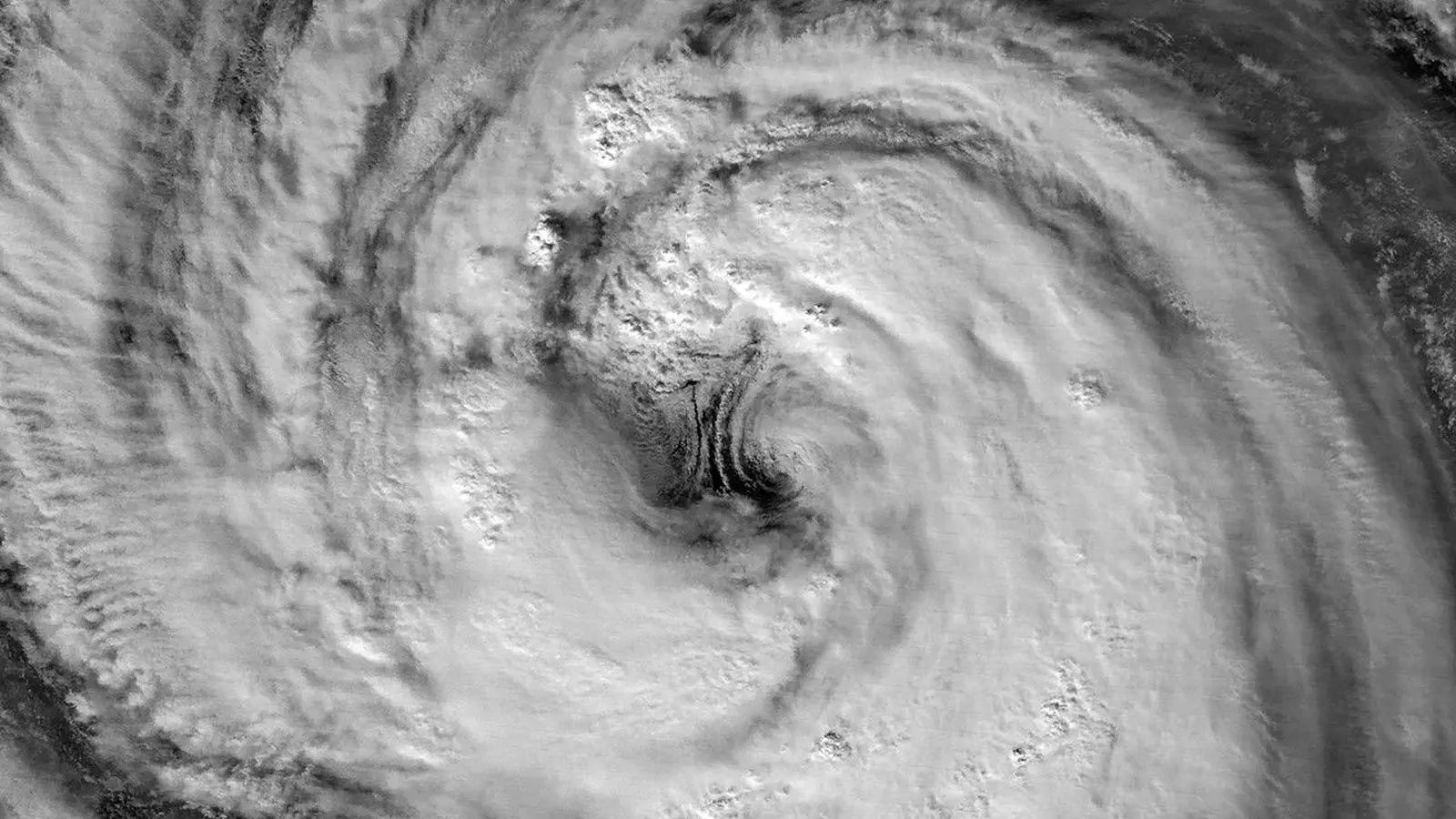
Seen from orbit, the storm’s eye looked impossibly clean—a round, dark well surrounded by roiling white. That quiet center belied a system churning hundreds of kilometers across the Philippine Sea, one that stalled and soaked swaths of southern Japan as it crawled northward in late May and early June 2026.
Nighttime satellite images captured Typhoon Jangmi’s giant eye and swirling cloud bands as the storm approached Japan.
When the lights go out, the view gets sharper
Infrared and low-light sensors onboard polar-orbiting satellites often reveal details that daylight scenes can wash away. On May 30 at about 16:40 Coordinated Universal Time (1:40 a.m. Japan Standard Time on May 31), the VIIRS instrument aboard the Suomi NPP satellite recorded a striking nighttime portrait of Jangmi. The photograph shows an unusually large eye and a dense eyewall, a pattern meteorologists watch closely because it speaks to both organization and potential intensity.
At that moment the Joint Typhoon Warning Center reported 1-minute sustained winds near 120 kilometers per hour (75 miles per hour), roughly equivalent to a Category 1 hurricane on the Saffir-Simpson wind scale. Satellite imagery one day later, from VIIRS on NOAA-20 at about 16:40 UTC on May 31 (1:40 a.m. JST on June 1), showed the system strengthening. The JTWC then put sustained winds around 130 kilometers per hour (80 miles per hour).

Nighttime satellite images captured Typhoon Jangmi’s giant eye and swirling cloud bands as the storm approached Japan.
Clouds, rotation, and what the eye tells us
The eye’s size stood out. Scott Braun, a research meteorologist at NASA Goddard, noted the feature was larger than what is typical for many tropical cyclones. Surrounding the clear center, the eyewall was tightly wound—an arrangement that shelters strong convection and concentrates the storm’s most intense winds close to the core.
Low-level rotation showed up on the eastern flank beneath higher cloud layers. These small-scale rotations, often called mesocyclones when they are detectable, are not rare in well-organized tropical cyclones; they’re part of the internal turbulence that can modulate rainfall intensity and local wind gusts.
Trajectory and local impacts
Through May 31 and into early June, Jangmi tracked north-northwest. Its center remained south of Okinawa while expansive outer bands already reached parts of Japan. Forecast models at the time indicated a close passage near Okinawa followed by a turn toward the northeast, approaching the Amami islands around June 1-2. Slow motion matters here: a sluggish translation speed lengthens the period of heavy rain and elevates flooding risk along the Pacific-facing coastline.
Local authorities and media flagged concerns about intense rainfall and coastal impacts. For communities on Okinawa and the Amami archipelago, the combination of sustained winds, persistent bands of downpour, and elevated seas called for readiness—evacuation plans, sandbagging in low-lying areas, and careful monitoring of river gauges.
Satellite technology and the future
VIIRS low-light imaging is invaluable for night reconnaissance, revealing storm geometry and cloud-top structure when human eyes and conventional cameras can’t help. As satellites gain higher resolution and faster revisit times, forecasters will get earlier, clearer signals of rapid organization or weakening—information that improves warnings and saves lives.
Overall, Jangmi illustrated how nighttime satellite observations complement daytime views, turning a planet of dim clouds into a readable map of risk for those on the ground.

“The cosmos has always fascinated me. I write about space missions, astronomy, and the technologies pushing humanity beyond Earth.”

Discussion
Leave a Comment