
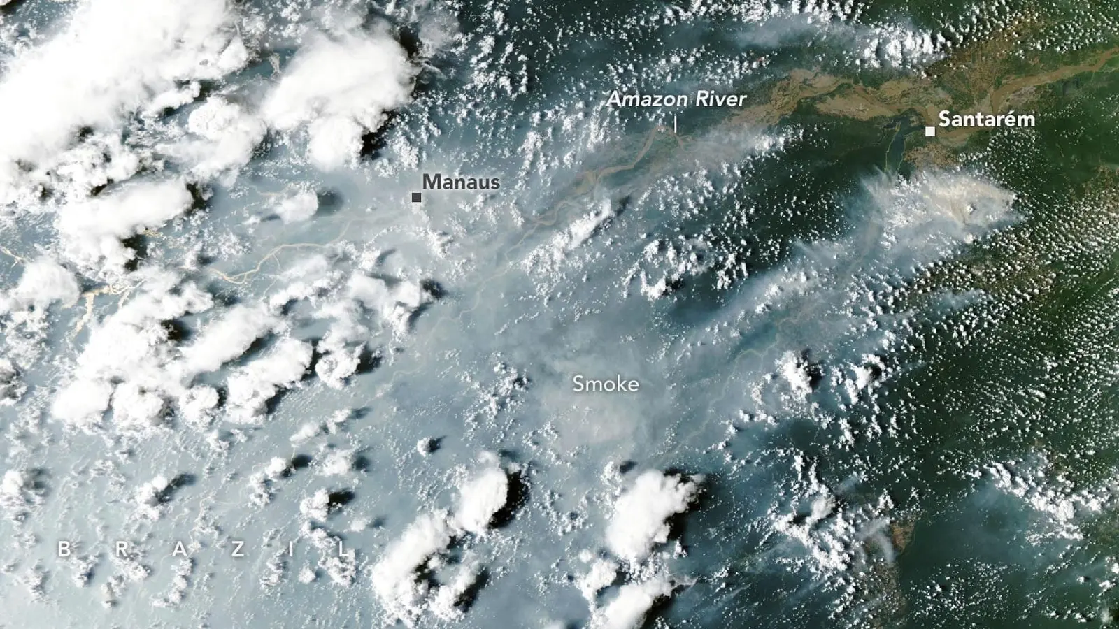
Thick smoke turned Manaus into a dim, gray sketch: traffic lights haloed in haze, schoolyards emptied, and a city of two million people told to keep children indoors. Those scenes are not anomalies caught on a single bad day. They are the visible edge of a broader, El Nino-driven wildfire cascade that began thousands of miles away and is now advancing through the Amazon.
How a tropical chain reaction builds
El Nino does not ignite forests. It rearranges the weather patterns that make ignition more likely and burning harder to control. By shifting rainfall away from its usual equatorial tracks, El Nino produces extended dry spells across Southeast Asia, the central tropics, and the Amazon basin. In 2026, those shifts intensified drought in key Amazon regions, leaving the understory tinder-dry and millions of hectares vulnerable.
Scientists describe the phenomenon as a cascade because the sequence repeats and amplifies across regions. It often starts with peat and landscape fires in equatorial Asia, where exceptionally dry conditions allow smoldering peat to burn for weeks. Smoke and aerosols can then influence atmospheric circulation, while human practices that rely on seasonal fires take advantage of the drier windows in other tropical zones. When those human-set burns escape, the result is a chain of outbreaks stretching from Indonesia to the forests that ring the Amazon River.
Satellite systems have tracked this progression in 2026. Datasets such as NASA’s FIRMS, GFED, and imagery from MODIS and VIIRS show a marked rise in fire detections and smoke emissions across the central and eastern Amazon since September. The hotspot map stretches from the forests around Manaus and Santarém eastward toward the Atlantic. But the satellite signals are only part of the story.
Smoke, public health, and local impacts
On October 12, 2026, MODIS aboard NASA’s Aqua satellite imaged enormous smoke plumes rising on both sides of the Amazon River. That day Manaus recorded PM2.5 concentrations above 135 micrograms per cubic meter. To put that number in context: such levels place air quality in the unhealthy to very unhealthy categories, triggering school closures and cancellations of public events. Respiratory clinics reported spikes in patients. For many residents, the immediate threat was the thick, choking air; for ecologists, the worrying sign was where the smoke originated.
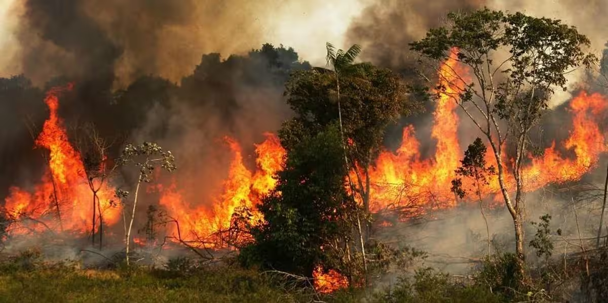
These fires are not randomly distributed. They cluster around transportation and agricultural hubs where land-use pressures and human activities are highest. Many start as controlled burns for clearing pastures or crop residue. In a normally wet Amazon, those fires pose little threat beyond the targeted plot. In a drought intensified by El Nino, however, escaped blazes can penetrate the forest understory, ignite ladder fuels, and spread beneath the canopy in ways that satellites often struggle to detect.
Hidden fires and the limits of satellites
Satellites are indispensable tools, but they have blind spots. Thick smoke and cloud cover block thermal signatures. Dense canopy shades small, understory fires from infrared sensors. That is why NASA researchers are combining conventional active-fire products with more sensitive searches for what they call candidate fires.
Why some fires remain invisible
- Understory burns produce weaker heat signals and are easily masked by the forest canopy.
- Heavy smoke can saturate sensors, making active fire detections fall steeply on the smokiest days.
- Small, smoldering peat fires emit less shortwave infrared energy, yet can persist and spread slowly over time.
Shane Coffield, an assistant research scientist at the University of Maryland working with NASA Goddard, has found that adding candidate-fire detections from VIIRS raises apparent fire counts by roughly 40 percent in areas such as Santarém. That gap matters. If monitoring underestimates how many fires are burning, emissions inventories, public warnings, and firefighting priorities can all lag the on-the-ground reality.
And yet satellites remain the fastest way to see change across a basin the size of the continental United States. The challenge now is to refine detection algorithms, integrate ground reports, and push for more frequent, higher-resolution observations that can pierce smoke and canopy cover.
Human ignition, ecological vulnerability, and carbon consequences
Lightning causes fewer than one percent of fires in the Brazilian Amazon. The vast majority are human-started: agricultural clearing, pasture management, accidental escapes. What makes 2026 unusually dangerous is not the ignition mechanism itself but the conditions in which those ignitions occur. Rainfall in Manaus was nearly 95 percent below normal in August and 60 percent below normal in September, according to Brazil’s National Institute of Meteorology. Dry soils, desiccated vines, and flammable leaf litter turned routine burns into potential forest fires.
That is a grave ecological problem. Tropical rainforest species lack adaptations to frequent fire. Repeated burning can convert closed-canopy forest to more open, fire-prone savanna-like conditions. Previous El Nino events, especially 2015-2016 and 2023, left scars: partially charred trees, weakened canopy continuity, and simplified forest structure. Those legacies lower the threshold for subsequent fires to spread more intensely.
From a climate perspective, Amazon fires release carbon stored in vegetation and soils. Peat and deep organic layers are particularly carbon-rich. When they burn, they emit greenhouse gases that feed back into the climate system, potentially increasing the odds of further droughts. That is the feedback loop scientists fear: drought enables fire, fire releases carbon, carbon warms the climate, and warming fosters more drought.
What comes next and where the risk is highest
Researchers expect the cascade to progress. In the short term, November and December pose elevated risks for northern states such as Roraima, Amapá, and northern parts of Pará, as well as neighboring Guyana, Suriname, and parts of Venezuela. Longer-term projections suggest drought and fire risk will migrate southward, peaking in southern Amazon regions of Brazil and in parts of Paraguay around August and September 2027.
That timeline offers both cause for alarm and a narrow window for mitigation. Where rain has not yet failed, authorities and landholders can reduce fire use, enforce burn bans, and support rapid suppression efforts. In drought-stricken zones, the priority shifts to protecting urban populations from smoke, prioritizing firefighting resources, and safeguarding intact forest patches that serve as refuges for biodiversity.
Expert Insight
"This event is a reminder that large-scale climate patterns and local land management interact in ways we cannot ignore," said Dr. Elena Rios, a tropical fire ecologist with two decades of field experience in Amazon conservation. "When people use fire as a land-management tool under normal conditions, the ecosystem can recover. When drought and degraded forest structure combine, resilience collapses. Stopping fires now is the simplest and most effective step we can take to protect communities and carbon stores."
Dr. Rios emphasized practical measures: immediate enforcement of no-burn periods, support for smallholder alternatives to slash-and-burn, and investment in community-based early warning systems that pair satellite alerts with local observations.
Technology, monitoring, and policy responses
Improving detection is a technical and institutional challenge. Advances in sensor sensitivity, higher revisit rates, and machine learning approaches to fuse multispectral data can narrow the gap between what is burning and what we can see from space. Yet technology alone will not solve a largely human-driven problem. Policy measures that limit intentional burning, provide incentives for sustainable land management, and strengthen firefighting capacity are essential.
International cooperation helps too. The 2026 cascade demonstrates how climate drivers and land-use choices in one region can have cascading effects across oceans. Coordinated funding for rapid-response monitoring, emergency public-health measures, and longer-term forest restoration could reduce the odds that this year's fires become a new, persistent regime of burning in the Amazon.
Conclusion

The fires blanketing parts of the Amazon in 2026 are a symptom of a larger problem: climate variability amplified by El Nino interacting with human land-use. Satellites highlight the scale, but hidden fires under the canopy and smoldering peat may make the situation worse than official tallies suggest. The immediate choices are straightforward. Stop burning where possible. Protect the remaining intact forests. And invest in better detection and community-level responses so that when the next El Nino arrives, the cascade can be interrupted rather than repeated.

“The cosmos has always fascinated me. I write about space missions, astronomy, and the technologies pushing humanity beyond Earth.”

Discussion
Leave a Comment
Comments (1)
wow Manaus pics are haunting. Smoke like a gray sketch, kids kept inside… El Nino chain reaction is terrifying, but satellites miss stuff. we need local alerts, fast