
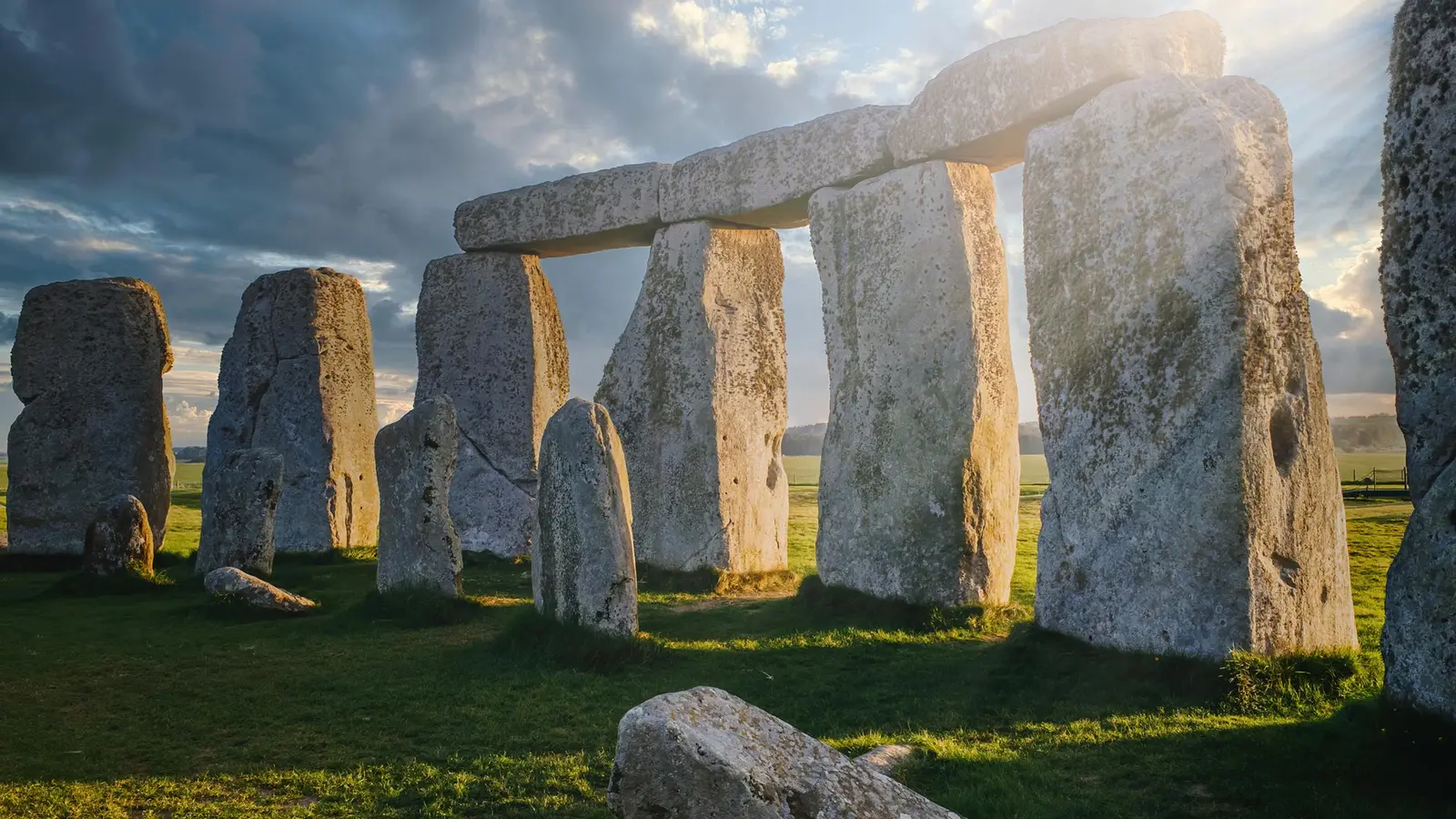
The idea of a single rock traveling most of Britain reads like a myth. Yet beneath Stonehenge’s stones is a quieter, more complicated story: the Altar Stone may have begun its voyage under ice, then finished it under human hands.
Glaciers, erratics and a 700-kilometre mystery
At first glance, the Altar Stone looks out of place. It is one of Stonehenge’s bluestones, a group of transported rocks that contrast with the locally sourced sarsens. Geochemical analyses link the Altar Stone to the Orcadian Basin in northeast Scotland, a basin that once housed Lake Orcadie and deposited the very sandstone we now see at Stonehenge.
How did that sandstone move nearly 700 kilometres to Salisbury Plain? The simplest answer is not necessarily the correct one. Large parts of northern Britain were covered by an ice sheet until roughly 15,000 years ago. Glaciers act like slow-moving conveyors, picking up boulders and depositing them far from their sources. Geologists call such transported blocks "erratics." Could a glacier have carried Altar Stone much of the way south?
To test that idea, researchers ran a numerical model that simulates ice flow and the likely deposition of erratics. The model, refined over several years of development, predicts where glacially transported rocks could have been left as ice thinned and retreated. Its output points toward a surprising intermediate: Dogger Bank, now submerged beneath the North Sea, but during and after the last ice age once part of a landscape called Doggerland.
Dogger Bank becomes the missing link in the route because it sits where a glacial moraine accumulated. A moraine is a ridge of rock and sediment deposited at the edge of moving ice; it marks the terminal zone of a glacial conveyor. Material swept south from the Orcadian Basin could plausibly have been deposited there, creating a concentrated patch of northern stones stranded far from home.
Doggerland’s rise and fall, and Neolithic choices
Doggerland is not just a geological curiosity. Archaeologists now recognize it as a former landmass that connected Britain to continental Europe. As the last ice age ended and seas rose, Doggerland changed—from an accessible migration route into a shrinking island and finally into a drowned landscape. People lived on it and passed through it for millennia.
Imagine walking across a coastal expanse crowded with unusual boulders, some of them clearly foreign to the lowlands. Neolithic peoples were skilled readers of stone. They selected rocks for tools and monuments, and they understood—through experience rather than formal geology—that some stones were special, prized, or distinctive. If the Altar Stone had been left among other northern erratics on Dogger Bank, its unusual provenance could have made it attractive to human collectors.
The chronology matters. Doggerland remained at least intermittently above sea level until between 9,000 and 7,000 years ago. Stonehenge, by contrast, acquired many of its bluestones around 4,000–5,000 years ago. That gap implies one or more intermediate moves. If the Altar Stone was stranded on Dogger Bank, early people would likely have transported it to a safer, terrestrial site as sea levels rose and landscapes shifted.
Once the Altar Stone reached Britain’s east coast, human-driven transport becomes more plausible. Moving a single 6-ton block across land or by water is difficult, but the scale of human cooperation and engineering in the Neolithic was underestimated for too long. The distance from the east coast to Salisbury Plain is comparable to the distances other bluestones traveled, and Neolithic pathways such as the Berkshire Ridgeway provided established routes. Those high-ground tracks follow dry, elevated ground and would have been natural corridors for long-distance movement of people and heavy objects.

The combined hypothesis—glacial transport to Dogger Bank followed by deliberate human relocation to Stonehenge—reconciles several observations. It accounts for the Altar Stone’s northern petrographic signature and it explains why Neolithic people might have invested effort in moving a stone that already had a long and visible journey behind it.

The Altar stone is towards the middle of Stonehenge.
Wider implications for archaeology and landscape change
Accepting a mixed route—partly glacial, partly human—reshapes how we think about prehistoric agency and landscape memory. It suggests Neolithic communities recognized stones as mobile landscape elements that carried stories. They did not simply source material locally; they sought meaning and connection in distant rocks.
There are technical implications as well. Using high-resolution geochemical fingerprinting alongside ice-flow models opens a way to map potential accumulation zones for erratics. That means submerged features like Dogger Bank should be treated as archaeological archives, not only palaeoenvironmental records. Surveying offshore moraines and associated deposits could reveal caches of exotic stones that once drew human attention.
What does this mean for Stonehenge? It reinforces the monument as a palimpsest of processes—glacial, coastal, and human. The stones encapsulate both deep time, in the form of ancient sediments, and human history, in the form of movement, selection, and display. That dual story is part of why Stonehenge continues to fascinate.
Expert Insight
"This mixed-transport model helps bridge geology and human behaviour," says Dr. Eleanor Marks, a fictional archaeologist and specialist in prehistoric mobility. "It explains why some stones at Stonehenge show petrological fingerprints from far north while others are local. People were not simple carriers; they were curators of landscape memory. When seas rose, they moved what mattered to them."
Conclusion
The Altar Stone’s journey was not a single cinematic heave from Scotland to Wiltshire. Instead, its story likely blends the slow power of ice with deliberate, purposeful human action. Glacial conveyor belts could have dropped it at a now-submerged crossroad, where later generations reclaimed and transported it inland. That layered pathway—geology shaping opportunity, people seizing it—offers a richer picture of how Stonehenge came to be, and of how prehistoric communities navigated a changing world.

“The cosmos has always fascinated me. I write about space missions, astronomy, and the technologies pushing humanity beyond Earth.”

Discussion
Leave a Comment
Comments (3)
Pretty cool idea, but feels a bit neat like a puzzle fitted to the data. Still I like the notion ppl treated stones as memory, makes Stonehenge feel more human
Is this even true? The model points to Dogger Bank but where's the physical proof offshore, actual erratics? If not found, whole chain is speculative tho, curious to see cores
Wow, glacier then humans? That's wild. Made me picture ancient ppl hauling a 6 ton rock over ridges, soaked and singing? lol